Japan
>Okinawa Pref
>Miyakojima City Hotels
>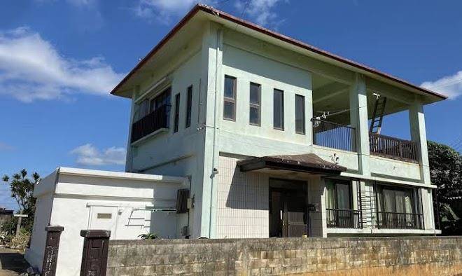
Info
Miyako Airport 21 min
Sunayama beach (23 min)
Picturesque beach cove with white sand & turquoise water, plus a foliage-covered, rock arch.
Nakanoshima Beach (13 min)
Ryuuguujo Observation Deck (32 min)
MarineShopBOND パイナガマビーチ店 (15 min)
Small city beach with calm, children-friendly waters, shower facilities & barbecue pavilions.
Shimoji-shima (11 min)
Island with a small airport, beaches with clear waters & areas for diving & snorkeling.
17END (16 min)
渡口の浜 (8 min)
Yonaha Beach (27 min)
Ikema Island (40 min)
Petite island & wildlife refuge with shops, a small secluded beach & birdwatching opportunities.
Kurima Island (32 min)
Secluded, teardrop-shaped isle with sugar cane & tobacco crops & a few basic tourism amenities.
Sankakuten (5 min)
Kurima Bridge (28 min)
Modern bridge connecting Miyakojima & Kurima islands, opened in 1995 & known for ocean panoramas.
Toriike Pond (15 min)
Water-filled sinkhole formed by limestone erosion, with a tunnel to the sea favored by divers.
Irabu Bridge (12 min)
SAWATA NO HAMA (11 min)
Expanse of sand dotted by boulders deposited by the 2011 tsunami, with camping & guesthouses.
Contact Number
Web Site
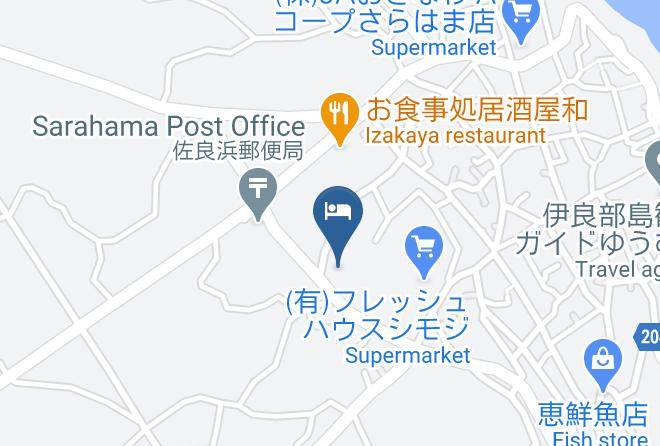
Address
Map Coordinates
Map