Australia
>New South Wales
>Byron Hotels
>
Info
Gold Coast Airport 56 min
Byron Bay - Visitor Information Centre (9 min)
Clarkes Beach (18 min.)
Sweeping, wide sandy beach known for surfing lessons & humpback whale sightings.
Paterson St Opp Browning St (9 min)
Julian Rocks Nguthungulli Nature Reserve (6 min)
Rocky outcrops in waters known for diving & snorkeling among gray nurse sharks, stingrays & turtles.
Cape Byron State Conservation Area (3 min.)
Lighthouse park and beach
Wategos Beach (5 min)
Picturesque, sheltered sandy beach popular for surfing, swimming, paddle boarding & picnicking.
The Farm Byron Bay (13 min.)
Working farm, plant nursery & sustainable market garden with tours, an onsite restaurant & a bakery.
Jonson St At Carlyle St (9 min)
Cape Byron (6 min)
Rugged headland & easternmost point of Australia, home to a panoramic lighthouse & low-key beaches.
Main Beach (14 min.)
Long sandy beach popular for swimming & surfing, with bars, restaurants & hotels nearby.
Belongil Beach (4 min.)
Tranquil 2.5-km. beach with lifeguards on select dates & a clothing-optional area at the north end.
Suffolk Park Coach Stop Broken Head Rd (7 min)
The Wreck (19 min.)
Popular, rustic surfing beach with offshore remains of a shipwreck that can be seen above the water.
Stone & Wood Brewery Byron Bay (8 min.)
Laid-back brewery with guided tours & tastings of signature ales & one-off batches, plus a canteen.
Arakwal National Park (18 min.)
Scenic area known for a sandy beach that's popular for wildlife viewing, swimming & fishing.
Crystal Castle & Shambhala Gardens (26 min.)
Attraction featuring massive geodes surrounded by subtropical gardens, plus a cafe & shop.
The Pass (4 min.)
Surf breaks, dolphin or whale sightings & sunset strolls on a beach overlooked by a lighthouse.
Tallow Beach (15 min.)
This expansive sandy beach in Arakwal National Park is a popular spot for swimming & birdwatching.
Contact Number
Web Site
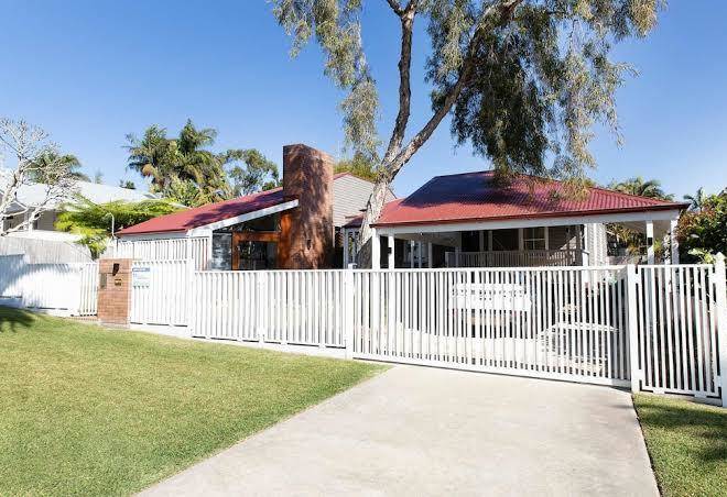
Description :
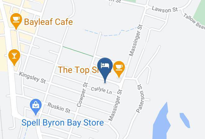
Address
Map Coordinates
Map