Poland
>Malopolskie
>Tatrzanski Hotels
>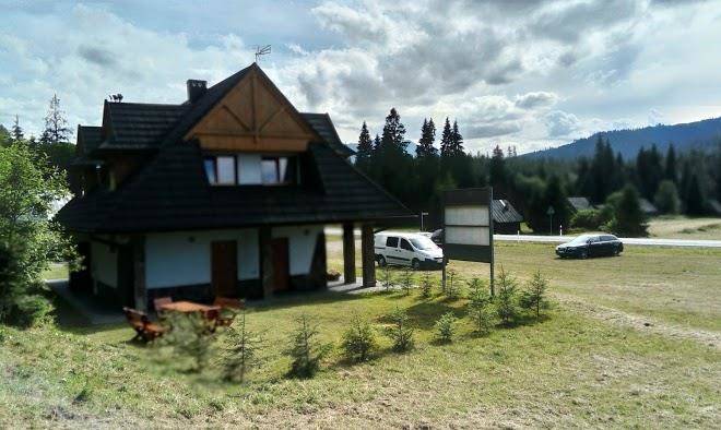
Info
John Paul II Kraków-Balice International Airport 1 hr 45
Giewont (39 min)
Popular with hikers, this mountain massif in Tatra National Park features 3 peaks & marked trails.
Popradské pleso (55 min)
Surrounded by woods & mountains, this picturesque lake also features trails, a lodge & restaurant.
Gerlachovský štít (1 hr 22)
The tallest High Tatras mountain range peak rising 8,709 feet over a glacial valley.
Skalnaté Pleso (51 min)
Mountain tarn at 5,745 ft. served by cable car, with food & gift outlets & a scientific observatory.
Dolina Gąsienicowa (31 min)
Picturesque valley for hiking amid pine trees, meadowland & a dramatic mountain backdrop.
Tatra National Park, Poland (33 min)
Expansive, mountainous national park with lakes, caves, wildlife & miles of scenic hiking trails.
Nosal (32 min)
Rising 1,206 m. above sea level, this forested mountain offers skiing, hang-gliding & paragliding.
Belianska Cave (18 min)
Sizable stalactite cave with lakes, waterfalls & seasonal music shows (only guided tours available).
Ski resort Kotelnica Białczańska (13 min)
Popular ski resort offering many downhill & cross-country trails, a snowboard park & eateries.
Belianske Tatras (11 min)
Alpine range with a peak elevation of 2,152 m. offering overnight accommodations in its foothills.
Gubałówka (47 min)
Majestic mountain offering hiking trails & a cablecar to the top, with panoramic views of the area.
Niedzica Castle (35 min)
14th century Gothic castle built on an outcrop overlooking Lake Czorsztyn & iconic symbol of Poland.
High Tatras (1 hr 22)
Sprawling mountain chain with dozens of scenic peaks, alpine lakes & a variety of hiking trails.
Zelené pleso (1 hr 10)
Vast nature reserve with a scenic, moderate hike to its lake & traditional mountain chalet.
Lomnický štít (1 hr 10)
Snow-capped mountain range peak reaching 8,642-feet with an observatory built in 1940 & cable cars.
Contact Number
Web Site
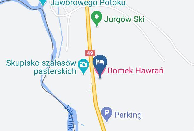
Address
Map Coordinates
Map