United States Of America
>California
>Marin Hotels
>
Info
San Francisco International Airport 1 hr 18
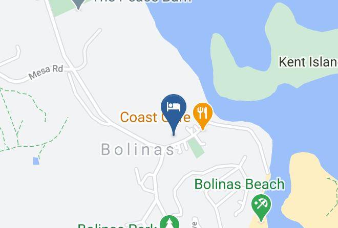
Bolinas Beach (8 min)
Sandy beach known for ideal surfing conditions & a popular site for dog walking.
Alamere Falls (14 min)
Day hikes to a scenic, remote spot where water cascades down a 30 ft. cliff onto a rugged beach.
Golden Gate National Recreation Area (44 min)
Coastal urban park with historic sites & activities from bicycling to hiking to water sports.
Rodeo Beach (58 min)
Pebbly beach popular for surfing & sunbathing, with restrooms, trails, a lagoon & picnic tables.
Hawk Hill (59 min)
Home to historic tunnels & forts, this peak is an iconic lookout point for migrating raptors.
Mount Tamalpais State Park (16 min)
Redwood groves plus hiking & biking trails that lead to sweeping views from a 2,571-foot peak.
Mount Tamalpais (35 min)
Scenic, well-networked mountain with stunning views & featuring over 100 miles of hiking & cycling.
Cataract Falls (26 min)
Series of small, scenic waterfalls in a forest setting, reachable via a moderate, dirt-trail hike.
Bolinas Lagoon (7 min)
Lagoon featuring various migratory birds, harbor seals & other wildlife, plus a nearby park & beach.
Samuel P Taylor State Park (24 min)
Park noted for its redwood groves & grassy hills offers camping, hiking trails & picnic areas.
Muir Woods National Monument (35 min)
Scenic, forested park featuring giant redwood trees, long hiking trails, a visitor center & more.
Marin Headlands (56 min)
A 5-mi. stretch of coastal basalt headland & habitat for bobcats, coyote, deer & abundant birdlife.
Point Bonita Lighthouse (59 min)
Historic active lighthouse reached by a half-mile trail offers visitor access & scenic ocean views.
The Marine Mammal Center (59 min)
All types of marine mammals are cared for & rehabilitated at this non-profit facility.
Palomarin Trailhead (14 min)
Trailhead & vault toilets for a challenging 6.5 mile hiking route taking in dramatic coastal falls.
Contact Number
Web Site
Title :
Address
Map Coordinates
Map