Ukraine
>Ivano Frankivsk
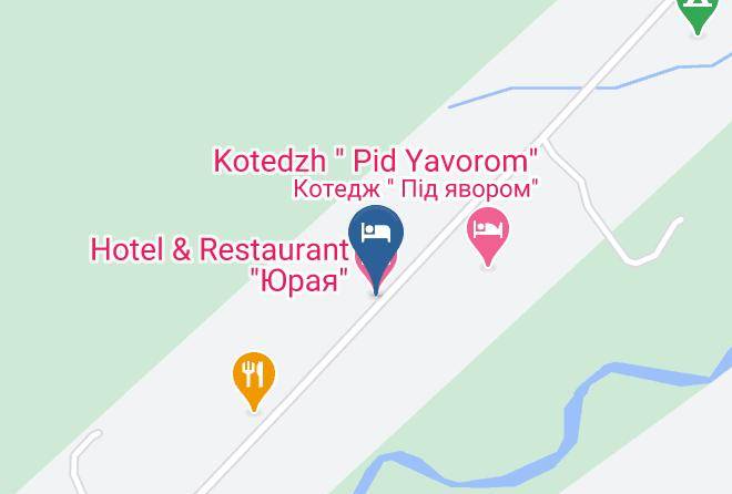
>Yaremcha Hotels
>
Info
International Aeroport Ivano-Frankivsk 1 hr 47
Hora Kostrycha (37 min)
Yablunetskyi pereval (40 min)
Scenic mountain road with views of the hills & valleys beyond, plus a cafe & souvenir shop.
Khom'yak (33 min)
Rocky, forested peak with trekking paths & a rope bridge, waterfalls & scenic panoramas.
Ozero Nesamovyte (41 min)
Loop trail passing swamp areas & berry bushes to a lake overlooking grassy hills & snowy peaks.
Hora Shpytsi (33 min)
Mountain and lake
Hoverla (2 hr 4)
Forested 6,762-foot-high mountain peak with panoramic views accessed by 6km & 12km long trails.
Mountain Dovha (2 hr 9)
A 6,627-ft. massif summit covered with meadow & forest & challenging hiking route.
Pip Ivan (2 hr 8)
Mountain peak known for picturesque views & the remains of a 1930s-era stone observatory.
Carpathian National Nature Park (18 min)
Vast expanse of protected wilderness in the mountains with river access & dozens of trails.
Chornohora (2 hr 4)
The highest mountain range in Western Ukraine, known for its hiking, climbing & scenic views.
Pip Ivan (1 hr 52)
Scenic hiking destination featuring a 2,022-m. mountain peak with the ruins of an observatory.
Brebeneskul (1 hr 52)
Mountain and lake
Kukul (13 min)
Hikers enjoy year-round views of distant mountains from this peak on the border of 2 regions.
Contact Number
Web Site
Address
Map Coordinates
Map