Japan
>Tokyo Met
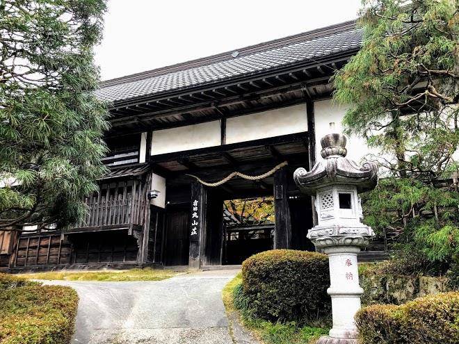
>Ome City Hotels
>
Info
Haneda Airport 1 hr 57
Hossawa falls (hinohara waterfall) (59 min)
A brief walk from a parking lot leads to this picturesque, 62-meter cascade in a natural setting.
Mount Jinba (1 hr 23)
Picnic tables & an artful horse statue top this 2,812-foot summit, a tranquil hiking destination.
Lake Sagami (1 hr 9)
Artificial lake created in 1947, offering rowboats for rent, fishing & scenic views.
Hinohara Tokyo Citizens' Forest (1 hr 17)
Forest therapy destination offering various hiking routes through tranquil mountain woods.
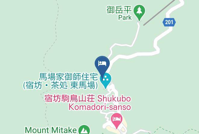
Mount Mitake (14 min)
A hiking trail & funicular lead to the top of this peak with a rock garden & Shinto shrine.
Lake Okutama (45 min)
Ringed by mountains & lush woods this expansive reservoir features hiking trails & scenic overlooks.
Nippara limestone caves (55 min)
Cave, autumn leaf color, and nature
Akigawa Valley (49 min)
Picturesque river gorge with rental fishing equipment & BBQs, campgrounds & a suspension bridge.
Mount Takao (1 hr 17)
Foliage-covered, 599-meter-tall peak with a funicular railway, hiking trails & a Buddhist temple.
Mt. Odake (1 hr 10)
Panoramic 4,154-foot summit with Mount Fuji & Tokyo views reached by trails & a cable car.
Gozenyama (51 min)
Connecting hiking trails lead up this mountain featuring scenic views from the peak.
Tokyo Summerland (49 min)
Sprawling aquatic amusement park featuring water slides, a lazy river & indoor swimming pools.
Musashi Mitake Shrine (13 min)
Historic red Shinto shrine at over 3,000 ft. elevation, accessed by a cable car.
Mt. Mito (1 hr 19)
Mountain offering hiking trails, beech forests & a waterfall, plus Mt. Fuji views atop the summit.
Mt. Kawanori (57 min)
Steep climbs up forested slopes with streams & waterfalls to a summit with sweeping views.
Contact Number
Web Site
Address
Map Coordinates
Map