Japan
>Kumamoto Pref
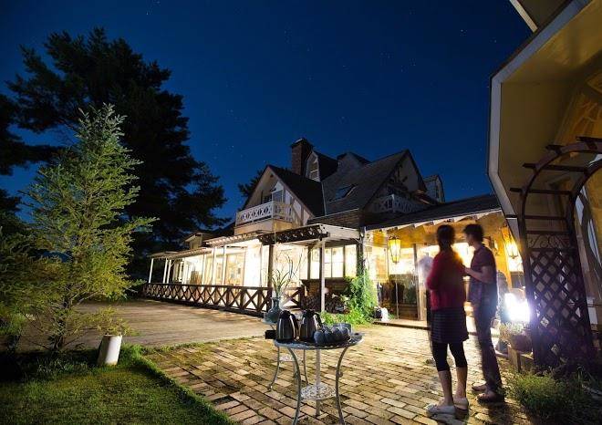
>Minamiaso Vil Aso District Hotels
>
Info
Kumamoto Airport 41 min
Aso Cuddly Dominion (39 min)
Zoo featuring many species of bears in basic enclosures & a petting area with cubs & dogs.
Mt. Neko (24 min)
Forested mountain famed for its colorful fall leaves, with a rocky hiking trail along a steep ridge.
Mt. Aso Nakadake Crater (29 min)
Active volcanic crater accessible by car, bus or walk that is sometimes closed due to toxic gas.
Isshingyo Sakura Tree (11 min)
400-year-old, 14-m.-high cherry tree located in Isshingyo Park, famous for its full bloom.
Aso-Kuju National Park (44 min)
Mountainous 280 sq. mile national park with a vast caldera, grassland, marshes & hot springs.
Shirakawa Suigen spring (19 min)
Greenery-surrounded river springs with water that can be bottled at the source, plus a shrine.
Takamoriyusui Tunnel Park (8 min)
Aso Farm Land (26 min)
Health-focused theme park for adults & kids with athletic activities, a petting zoo & spa services.
Mt. Nakadake (37 min)
Smoking caldera & lake on Mount Aso with visitor access to the rim, volcanic conditions permitting.
Mount Aso (36 min)
The circumference of this active volcano is around 75 miles & features a cone with 5 distinct peaks.
Daikanbo (51 min)
Mountaintop reached by car for 360-degree views, including rice fields in the caldera & other peaks.
Kamishikimi Kumanoimasu Shrine (13 min)
Picturesque Shinto shrine & natural arch, reached by a steep, wooded path lined with stone lanterns.
Aso Volcano Museum (37 min)
This compact, time-tested museum offers educational exhibits on volcanoes, along with a cafe.
Aso shrine (40 min)
Various festivals & rituals are held at this Shinto shrine dating back some 2,000 years.
Kusasenri (26 min)
Tranquil, grass-covered plateau with paths & views of Mt. Aso, Japan’s largest active volcano.
Contact Number
Web Site
Title :
Address
Map Coordinates
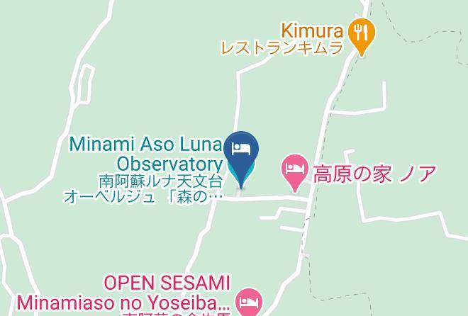
Map