Japan
>Kagoshima Pref
>Yakushima Townkumage District Hotels
>
Info
Yakushima Airport 12 min
Shiratani Unsui Gorge (43 min)
Tranquil hiking trails in thick woods with streams valley views & abundant flora & fauna.
Yakusugi Museum (5 min)
Museum mountaineering and nature
Mt. Miyanoura (1 hr 50)
The highest mountain on Yakushima (1936 m.) known for day hiking & its scenic 360 views.
Motchomudake (20 min)
Mountaineering mountain climbing and nature
Arakawa Mountain Trail Entrance (38 min)
Mountaineering
Wilson S Stump (43 min)
Mountaineering and nature
Drum Rock (43 min)
Mountaineering ecotourism and nature
Yakusugi Land (25 min)
Hirauchi Kaichu Natural Onsen (28 min)
Kuromidake (1 hr 50)
Mountaineering ecotourism and mountain
Senpirono Falls (22 min)
Crashing waterfall with a 60-meter drop in a jagged valley with an observatory to the south.
Kigensugi Cedar (48 min)
Nature and mountaineering
Contact Number
Web Site
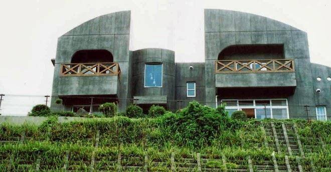
Title :
Address
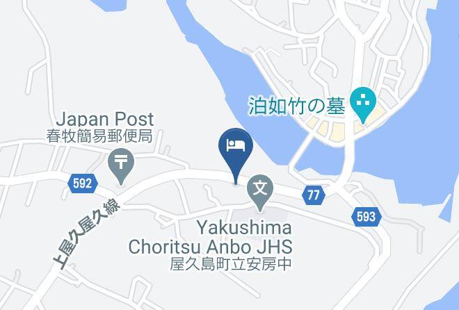
Map Coordinates
Map