Japan
>Yamanashi Pref
>Fujikawaguchiko Townminamitsuru District Hotels
>
Info
Mt. Fuji Shizuoka Airport 1 hr 48
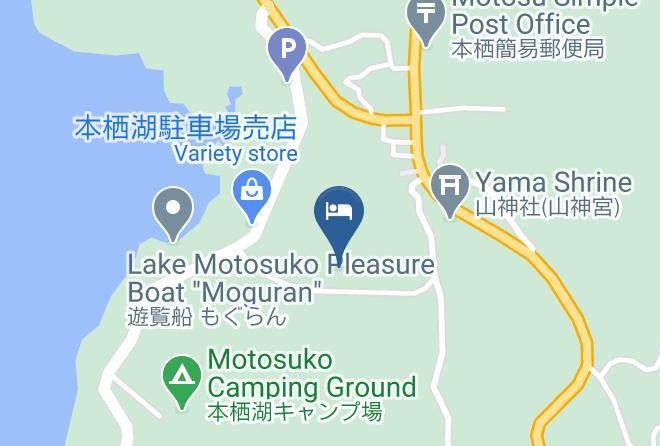
Lake Motosu (11 min)
Lake with a Mount Fuji backdrop & depths of nearly 400 ft., popular for camping, boating & fishing.
Shiraito Falls (23 min)
Unique, wide waterfall in the scenic, lush surrounds of Fuji-Hakone-Izu National Park.
Lake Saiko Bat Cave (15 min)
Saiko Lake (17 min)
Tranquil lake area offering forested hills, hiking paths, fishing & boating spots & Mt. Fuji views.
Aokigahara (18 min)
Vast natural area on the slopes of Mt. Fuji featuring a dense forest with a rugged lava-rock floor.
Mt. Fuji Panoramic Ropeway (32 min)
Aerial lift ascending to an observation deck with wide-open vistas of Mt. Fuji & Lake Kawaguchi.
Saiko Iyashi-no-Sato Nenba (Traditional Japanese Village) (15 min)
Reconstructed Japanese village where visitors can explore houses & rent traditional clothing.
Narusawa Ice Cave (14 min)
Small lava tube cave featuring pillarlike ice formations during the winter months.
Mount Fuji (1 hr 10)
Iconic snow-capped peak & volcano, the highest in Japan & the 7th highest island peak on earth.
Lake Shōji (9 min)
This serene, scenic lake with boats for rent is a popular destination for views of Mount Fuji.
Fuji-Q Highland (29 min)
Amusement park with huge roller coasters, haunted-theme rides & a kids' area, plus shops & cafes.
Fujiten Snow Resort (26 min)
Ski resort with a kids' area, snow park & views of Mt. Fuji, plus a lodge, cafe & equipment rentals.
Fugaku Wind Cave (12 min)
201-m. lava tube at the foot of Mt. Fuji, with unique geological features & dramatic ice pillars.
Roadside Station Asagiri Kougen (11 min)
This grassy plateau is popular as a Mt. Fuji viewing site & take-off point for hang-gliders.
Lake Kawaguchi (28 min)
Second-largest of the Fuji Five Lakes, this scenic getaway is known for fishing, camping & hiking.
Contact Number
Web Site
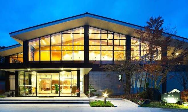
Title :
Address
Map Coordinates
Map