Czechia
>South Moravia
>Breclav Hotels
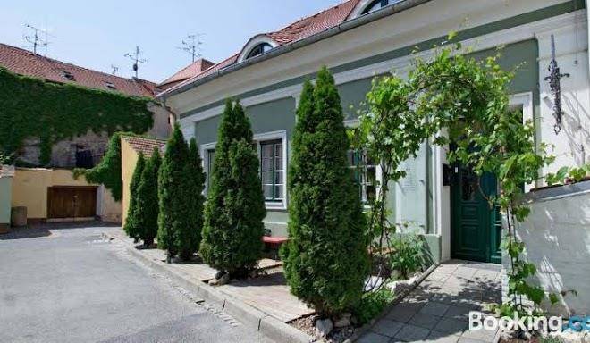
>
Info
Brno–Tuřany Airport 51 min
Svatý kopeček (10 min)
Limestone ridge with partially forested slopes & flower meadows, dotted with pilgrimage chapels.
Nové Mlýny reservoirs (20 min)
Reservoir with islands for nesting birds, hiking trails & shoreline views from a ruined castle.
The Valtice Palace (20 min)
Château, theatre, castle, wine, and chapel
Dietrichstein tomb (3 min)
Děvín in Moravia (17 min)
Forested peak & highest of the limestone Pálava hills, with a steep trail to 1200s castle ruins.
Cave Turold (12 min)
Rugged cave network with calcite formations in underground chambers & corridors, plus guided tours.
Minaret in Lednice (23 min)
Known as the Turkish Tower, an 1804 landmark with Arabic decor & spiral stairs to a turret lookout.
John's Castle (32 min)
Former hunting lodge modeled on a medieval castle with grand rooms, history tours & river views.
Pavlovské vrchy (19 min)
Trails across rugged limestone slopes & ridges marked by ruined hilltop castles & views over a lake.
Aqualand Moravia (47 min)
Water park on the site of Roman baths, with geothermal water, plus saunas & wellness amenities.
Lednice–Valtice Cultural Landscape (20 min)
A World Heritage-listed expanse with 2 castles & parkland dotted with pavilions & follies.
Pálava Protected Landscape Area (5 min)
Protected landscape encompassing meadows, forest & wetland, dominated by limestone hills.
Dívčí hrady (20 min)
A ruined, 1200s fortress on a rocky crag, accessed by steep trail & with forest & reservoir views.
Castle Lednice (21 min)
An 1800s palace built on a Renaissance chateau & Gothic fort, with a riding hall & formal gardens.
Mikulov Castle (5 min)
Rebuilt Baroque castle & museum exhibiting portraits, costumes, fine art & a viticulture gallery.
Contact Number
Web Site
Address
Map Coordinates
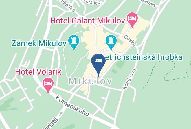
Map