Japan
>Kanagawa Pref
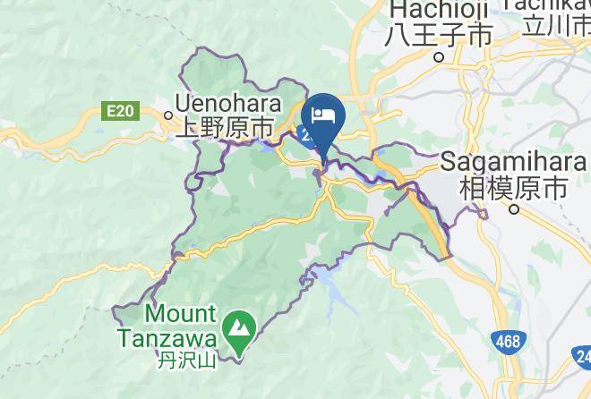
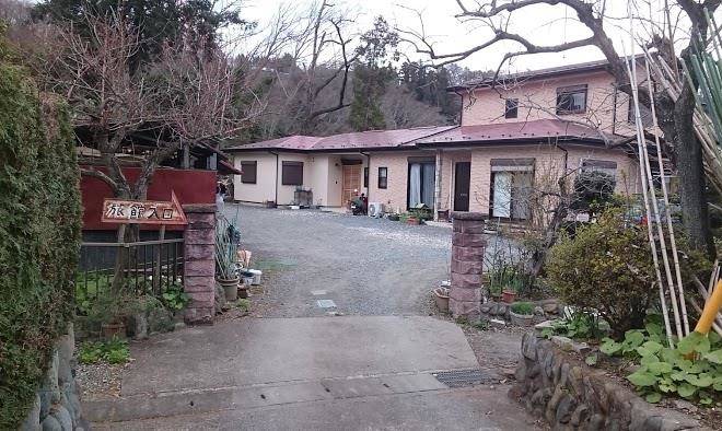
>Sagamihara City Midori Ward Hotels
>
Info
Haneda Airport 1 hr 18
Takao Trick art museum (24 min)
Mount Ōyama (1 hr 11)
Scenic 1,252 m tall mountain known to attract hikers & nature enthusiasts & for its sweeping views.
Kagenobuyama (48 min)
Forested peak offering hiking & climbing routes, plus sweeping views of Tokyo & the countryside.
Hachioji Castle ruins (37 min)
Lake Sagami (12 min)
Artificial lake created in 1947, offering rowboats for rent, fishing & scenic views.
Lake Sagami Pleasure Forest (9 min)
Unique park with rides & activities such as a climbing course & seasonal snow park, plus eateries.
Muscle monster (7 min)
Amusement tower with 3 tiers of climbing & balancing challenges & sweeping lake views at the top.
Miyagase Dam (19 min)
Begun in 1970 & finished in 2000, this massive gravity dam is located along the Nakatsu River.
Shiroyama (42 min)
Forested peak with hiking trails to a summit teahouse & lookout points facing Mount Fuji.
Lake Miyagase (19 min)
Artificial lake formed by a dam & known for scenic views of autumn leaves & nearby mountains.
Keio Takaosan Onsen Gokurakuyu (24 min)
Mount Takao (37 min)
Foliage-covered, 599-meter-tall peak with a funicular railway, hiking trails & a Buddhist temple.
Yakuou-in (19 min)
Built by Emperor Shomu in 744, this mountainside Buddhist temple features several tengu statues.
Sanrio Puroland (53 min)
Grand indoor Sanrio character park with rides & entertainment attractions, restaurants & shops.
Mount Jinba (38 min)
Picnic tables & an artful horse statue top this 2,812-foot summit, a tranquil hiking destination.
Contact Number
Web Site
Address
Map Coordinates
Map