Ukraine
>Zakarpattya
>Rakhiv Raion Hotels
>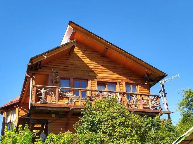
Info
International Aeroport Ivano-Frankivsk 1 hr 45
Zhenetsʹkyy Huk Vodospad (39 min)
Cascade reachable by a long trek along the Zhenetz River & through dense woodland.
Carpathian National Nature Park (41 min)
Vast expanse of protected wilderness in the mountains with river access & dozens of trails.
Stih (1 hr 9)
Panoramic views & ski runs on a mountain summit accessible by chairlift, with a Virgin Mary statue.
Yablunetskyi pereval (12 min)
Scenic mountain road with views of the hills & valleys beyond, plus a cafe & souvenir shop.
Drahobrat (59 min)
Rustic ski & snowboard resort at 1,400 m., known for its ample off-piste & freeriding terrain.
Hoverla (1 hr 13)
Forested 6,762-foot-high mountain peak with panoramic views accessed by 6km & 12km long trails.
Ozero Nesamovyte (1 hr 33)
Loop trail passing swamp areas & berry bushes to a lake overlooking grassy hills & snowy peaks.
Mountain Dovha (1 hr 29)
A 6,627-ft. massif summit covered with meadow & forest & challenging hiking route.
Chornohora (1 hr 13)
The highest mountain range in Western Ukraine, known for its hiking, climbing & scenic views.
Hora Blyznytsya (59 min)
Mountain and lake
Bukovel (27 min)
Extensive resort for skiing, mountain biking & hiking in the Carpathian mountain range.
Khom'yak (22 min)
Rocky, forested peak with trekking paths & a rope bridge, waterfalls & scenic panoramas.
Drahobrat (1 hr 7)
Lake Molodosti (30 min)
Vodospad Trufanetsʹ (20 min)
Contact Number
Web Site
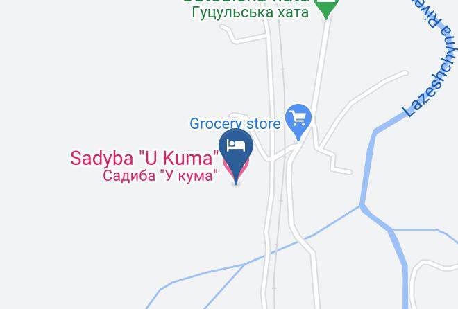
Address
Map Coordinates
Map