Poland
>Malopolskie
>Tatrzanski Hotels
>
Info
John Paul II Kraków-Balice International Airport 1 hr 59
High Tatras (1 hr 30)
Sprawling mountain chain with dozens of scenic peaks, alpine lakes & a variety of hiking trails.
Tatra National Park (1 hr 1)
Sprawling mountain preserve bordering Poland with 600 km of hiking trails, 300 caves & 100+ lakes.
Dolina Pięciu Stawów Polskich (1 hr 49)
Valley with popular hiking routes past lakes & waterfalls, offering spectacular mountain scenery.
Lomnický štít (1 hr 17)
Snow-capped mountain range peak reaching 8,642-feet with an observatory built in 1940 & cable cars.
Popradské pleso (1 hr 2)
Surrounded by woods & mountains, this picturesque lake also features trails, a lodge & restaurant.
Kasprowy Wierch (3 hr 51)
1,987-m. mountain, accessed by cablecar & a popular destination for skiing & hiking.
Gubałówka (52 min)
Majestic mountain offering hiking trails & a cablecar to the top, with panoramic views of the area.
Czarny Staw pod Rysami (2 hr 6)
5,000+ feet above sea level, this majestic lake is popular among hikers & features stunning views.
Tatra National Park, Poland (31 min)
Expansive, mountainous national park with lakes, caves, wildlife & miles of scenic hiking trails.
Gerlachovský štít (1 hr 30)
The tallest High Tatras mountain range peak rising 8,709 feet over a glacial valley.
Morskie Oko (1 hr 36)
Scenic views feature at this tree-ringed lake, the largest & fourth-deepest in the Tatra mountains.
Kriváň (1 hr 43)
Iconic 2,495m-high peak in the High Tatra Mountains featuring marked hiking trails & sweeping views.
Giewont (41 min)
Popular with hikers, this mountain massif in Tatra National Park features 3 peaks & marked trails.
Štrbské Pleso (1 hr 5)
Glacial lake with a picturesque mountain backdrop, offering resorts & a waterfront hiking trail.
Rysy (2 hr 45)
The highest peak in Poland, this popular hiking destination features alpine lakes & views in summer.
Contact Number
Web Site
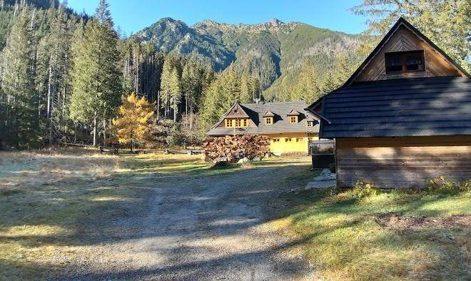
Title :
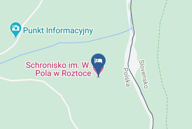
Address
Map Coordinates
Map