Japan
>Yamanashi Pref
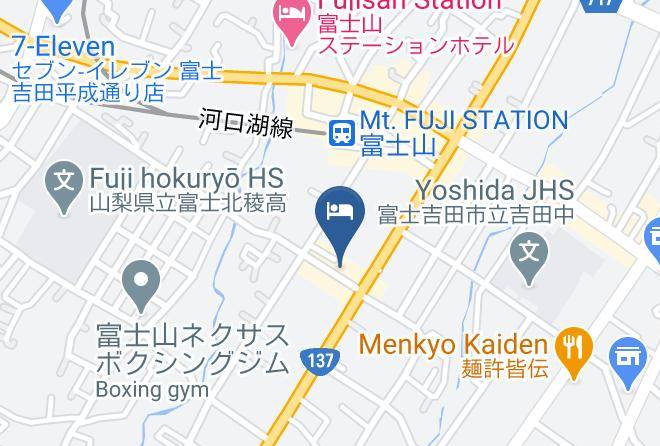
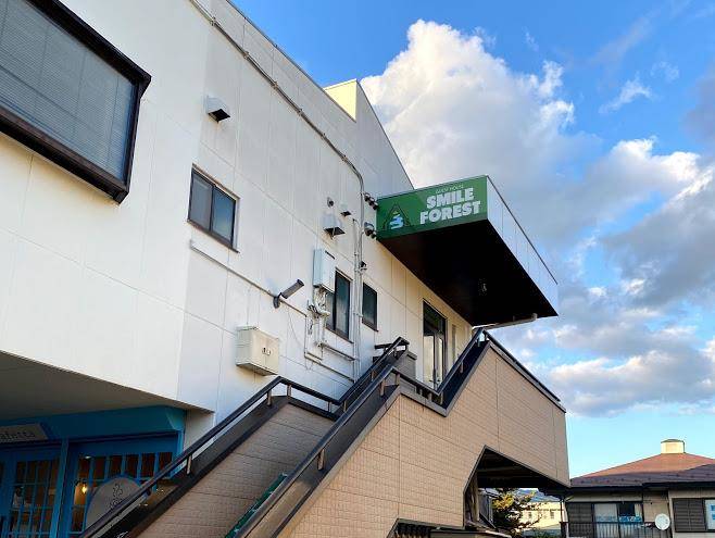
>Fujiyoshida City Hotels
>
Info
Haneda Airport 1 hr 52
Fuji-Q Highland (6 min)
Amusement park with huge roller coasters, haunted-theme rides & a kids' area, plus shops & cafes.
Arakurayama Sengen Park (11 min)
Park with many stairs leading to seasonal cherry blossoms, a pagoda & dramatic views of Mt. Fuji.
Thomas Land (4 min)
Lake Yamanaka (22 min)
Lakeside walks, bike rides & water activities in a picturesque site with Mount Fuji in the distance.
Lake Kawaguchi (14 min)
Second-largest of the Fuji Five Lakes, this scenic getaway is known for fishing, camping & hiking.
Kitaguchi-hongu Fuji Sengen Shrine (5 min)
Shinto shrine complex with wooden structures & stone lanterns lining the paths through the forest.
Eejanaika (5 min)
High-speed roller coaster best known for seats that rotate back & forth during drops & twists.
Mount Fuji (1 hr 11)
Iconic snow-capped peak & volcano, the highest in Japan & the 7th highest island peak on earth.
Takabisha (5 min)
Do Dodonpa (10 min)
Amusement park at Mount Fuji's base featuring rides, food, horror experiences & anime attractions.
Mt. Fuji Panoramic Ropeway (10 min)
Aerial lift ascending to an observation deck with wide-open vistas of Mt. Fuji & Lake Kawaguchi.
Oshino Hakkai (15 min)
Small village in a scenic setting with 8 ponds, views of Mt. Fuji & vendors of food & souvenirs.
Oishi Park (17 min)
Fujiyama (7 min)
High-speed steel roller coaster renowned for its tall height & series of intense drops.
Chureito Pagoda (11 min)
Iconic pagoda on a hilltop facing Mt. Fuji in Arakurayama Sengen Park, reached via 398 steps.
Contact Number
Web Site
Address
Map Coordinates
Map