Japan
>Gifu Pref
>Takayama City Hotels
>
Info
Toyama Airport 1 hr 30
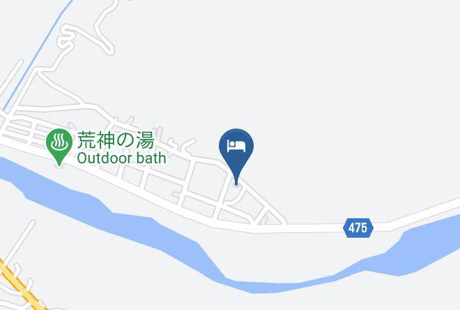
Shinhotaka Onsen (6 min)
Hot springs resort town with various lodgings, camping, dining, shops, souvenirs & nature hikes.
Mount Hotaka (33 min)
Various hiking routes lead to the summit of this famous 10,470-ft. mountain with alpine huts.
Hirayu Falls (19 min)
Towering, scenic waterfall offers year-round views, nearby trails & an annual winter festival.
Hida Great Limestone Cave (42 min)
Large, high-altitude limestone cave with 3 separate areas, unique rock formations & a museum.
Karasawa Hutte (33 min)
Pared-down quarters & a restaurant in a seasonal no-frills hostel surrounded by the Hida Mountains.
Okuhida Bear Park (11 min)
Small-scale enclosure with dozens of black bears, where visitors can throw food & take photos.
Mt. Sugoroku (43 min)
Summit with a ridge path amid bushes & alpine meadows, plus sweeping views of surrounding peaks.
Mount Yake (27 min)
This famous mountain in the Hida range is an active volcano & offers hiking on one of its peaks.
Kasagatake (17 min)
Hida Mountains peak in Chūbu-Sangaku National Park featuring climbing routes & mountain huts.
Mount Yari (43 min)
Soaring mountain peak known for its challenging trekking routes & striking panoramic views.
Mt. Minamidake (33 min)
Towering mountain with huts & a campsite that provide a base for the challenging summit hike.
Nishiho Hut (1 hr 27)
Modest hostel on a hiking route, with simple shared & private rooms, plus dining & mountain views.
Nishihotakadake (31 min)
Picturesque mountain peak with panoramic views, scenic hiking trails & a popular ropeway.
Shirahone Onsen (40 min)
Known for its milky-white water, this open-air hot spring features mountain scenery & fall leaves.
Kamikochi (34 min)
Forested national park in the Japanese Alps featuring hiking trails, lodging & picturesque views.
Contact Number
Web Site
Address
Map Coordinates
Map