Czechia
>South Moravia
>Breclav Hotels
>
Info
Brno–Tuřany Airport 45 min
Aqualand Moravia (41 min)
Water park on the site of Roman baths, with geothermal water, plus saunas & wellness amenities.
Svatý kopeček (17 min)
Limestone ridge with partially forested slopes & flower meadows, dotted with pilgrimage chapels.
Minaret in Lednice (23 min)
Known as the Turkish Tower, an 1804 landmark with Arabic decor & spiral stairs to a turret lookout.
Dívčí hrady (2 min)
A ruined, 1200s fortress on a rocky crag, accessed by steep trail & with forest & reservoir views.
Mikulov Castle (16 min)
Rebuilt Baroque castle & museum exhibiting portraits, costumes, fine art & a viticulture gallery.
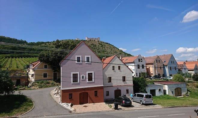
Děvín in Moravia (1 min)
Forested peak & highest of the limestone Pálava hills, with a steep trail to 1200s castle ruins.
Cave Turold (13 min)
Rugged cave network with calcite formations in underground chambers & corridors, plus guided tours.
Pálava Protected Landscape Area (8 min)
Protected landscape encompassing meadows, forest & wetland, dominated by limestone hills.
John's Castle (32 min)
Former hunting lodge modeled on a medieval castle with grand rooms, history tours & river views.
The Valtice Palace (29 min)
Château, theatre, castle, wine, and chapel
Pavlov Archaeological Park (15 min)
Nové Mlýny reservoirs (14 min)
Reservoir with islands for nesting birds, hiking trails & shoreline views from a ruined castle.
Castle Lednice (20 min)
An 1800s palace built on a Renaissance chateau & Gothic fort, with a riding hall & formal gardens.
Pavlovské vrchy (7 min)
Trails across rugged limestone slopes & ridges marked by ruined hilltop castles & views over a lake.
Lednice–Valtice Cultural Landscape (19 min)
A World Heritage-listed expanse with 2 castles & parkland dotted with pavilions & follies.
Contact Number
Web Site
Address
Map Coordinates
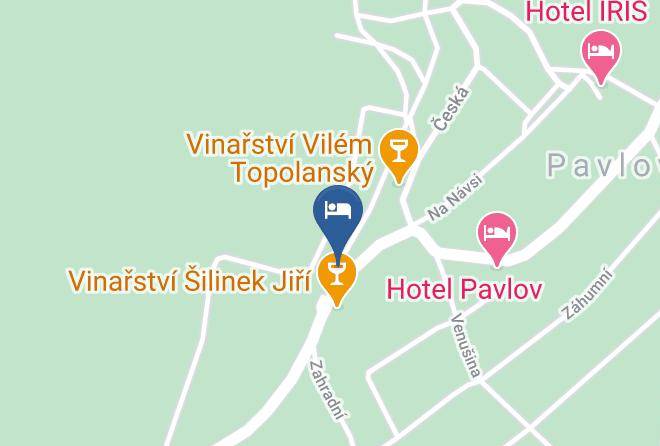
Map