Poland
>Dolnoslaskie
>Walbrzyski Hotels
>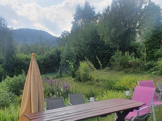
Info
Wrocław Nicolaus Copernicus Airport 1 hr 32
Old Mine Science and Art Centre in Wałbrzych (26 min)
Museum, mining, and art
Błędne Skały (1 hr 6)
Series of named rock formations that form a natural labyrinth in the Stołowe Mountains.
Stone Mountains (37 min)
Situated along the Czech border, this scenic mountain peak is known for its steep, forested slopes.
Góra Ostoia (47 min)
Underground complex of concrete halls & tunnels, built 1943–45 as part of the Nazis' Project Riese.
Waligóra (22 min)
936m-elevation peak in the Sudetes range with hiking, backcountry skiing & mountain biking.
Andrzejówka hostel (22 min)
Mountain, skiing, and ski resort
Broumovsko Protected Landscape Area (25 min)
Protected area of wildlife habitats & sandstone rock formations, with views of the nearby mountains.
Chełmiec (45 min)
Landmark peak featuring trails for hiking & mountain biking, plus a watch tower with aerial views.
Adršpach-Teplice Rocks (17 min)
Nature reserve with a group of imposing sandstone rock formations for tours & rock climbers.
Grodno Castle (36 min)
Partially restored medieval fortress set atop a mountain with tours & scenic tower climbs available.
Teplické skály (21 min)
Underground City Osówka (41 min)
Underground network of tunnels & rooms, dug for the Nazis by slave workers, its purpose uncertain.
Borowa (32 min)
This lush mountain features hiking trails & an observation tower with panoramic views.
Ostaš (22 min)
Several routes lead up & around spindly sandstone rock formations in this climbing & hiking area.
Adršpašské skály (18 min)
Towering, unusual sandstone formations interspersed among walking paths, forest & a large lake.
Contact Number
Web Site
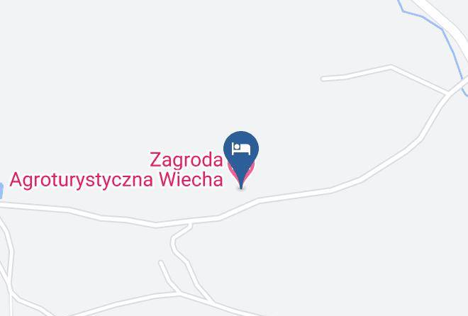
Address
Map Coordinates
Map